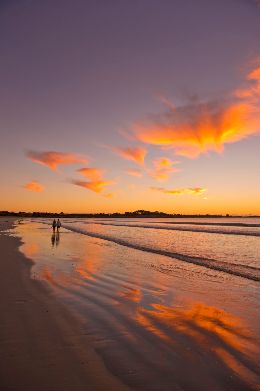
Sprawling along the blue waters of Guichen Bay, Robe, 355km east of Adelaide, was once South Australia’s second largest port.
Home to around 1500 lucky permanent residents, the town’s population swells with visitors during holiday periods, but offseason this charming town is laid-back and peaceful, and an ideal place to kick start any journey.
One of South Australia’s oldest towns, Robe is also the starting point for one of the most remarkable yet little-known treks in Australian history.


In the late 1850s and early 1860s more than 16,000 people left their homes in China and landed in Guichen Bay. They then walked hundreds of kilometres to reach the Victorian goldfields, a journey anyone can follow today.
The Chinese miners trekked through the bush on a number of routes. One of the most common was via Penola, Casterton, Cavendish, Dunkeld and then on to Ararat, the only Australian city to be founded by Chinese.
Robe to Penola – 108km
The views across Guichen Bay from the Robe Hotel are among the best in town.
This venerable pub was first licensed in 1848, when it was called the Bonnie Owl. The ruins of the original building can be seen at the rear of the current hotel, which dates from the 1880s and is still a popular watering hole today.
In the early 1900s Robe was referred to as the ‘Sanatorium of South Australia’ because of its rejuvenating sea air and pristine waters.
Today Robe has plenty to offer 21st century holidaymakers, from anglers and surfers to fans of four-wheel-driving.
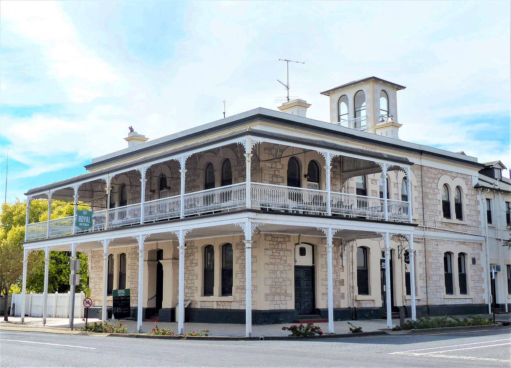 Penola - Royal Oak Hotel
Robe has five main beaches - Hooper’s Beach, Fox’s Beach, West Beach, Town Beach, and Long Beach, a glorious 17-kilometre-long stretch of golden sands.
The town is also popular for fresh seafood, and you can purchase the best from local outlets, or it’s usually on the menu at local hotels and restaurants including Sails At Robe and the Caledonian Inn.
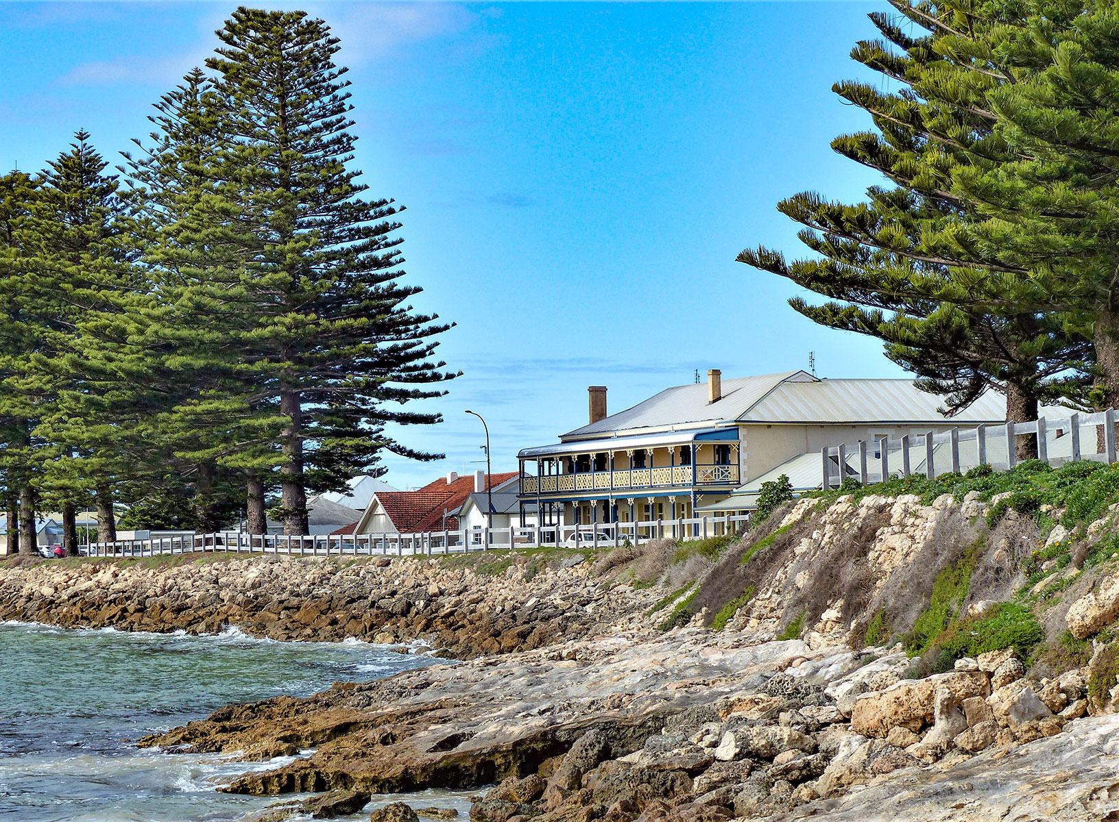 Robe Hotel
Robe has preserved its many fine historic buildings. More than 70 are Heritage-listed and the Caledonian, dating from1858, is one of them.
Robe’s oldest precinct is called Royal Circus. The town’s circa 1863 Customs House (now a museum) stands on Royal Circus and, opposite this on the foreshore, is the Pai Fang Gate, a traditional Chinese welcome gate.
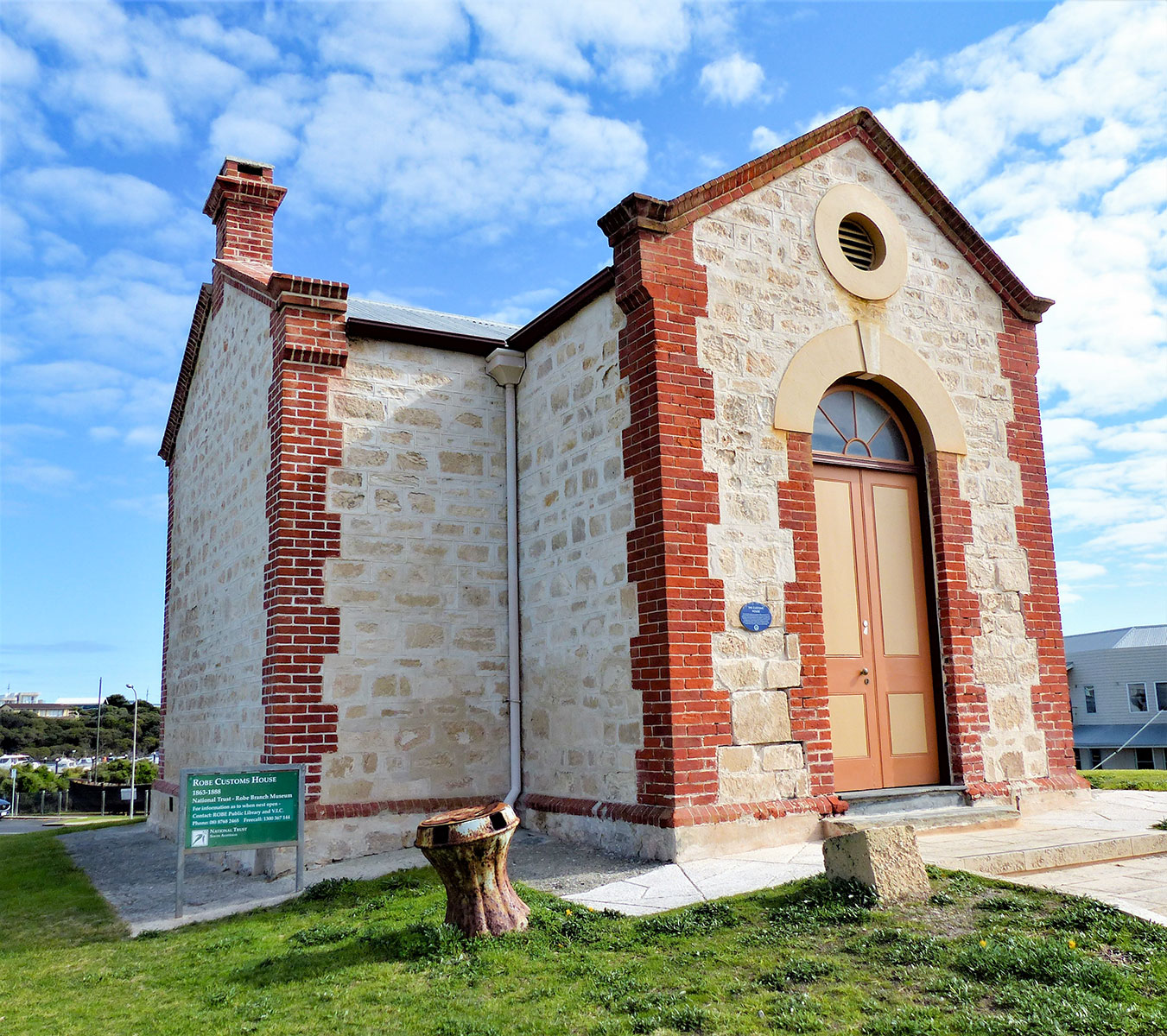 Robe - Customs House
Between 1857 and 1863, 16,261 Chinese men and one woman, mostly from China’s Fujian and Guangdong provinces, arrived in Robe in search of what the Cantonese called Dai Gum San - their mythical new gold mountain.
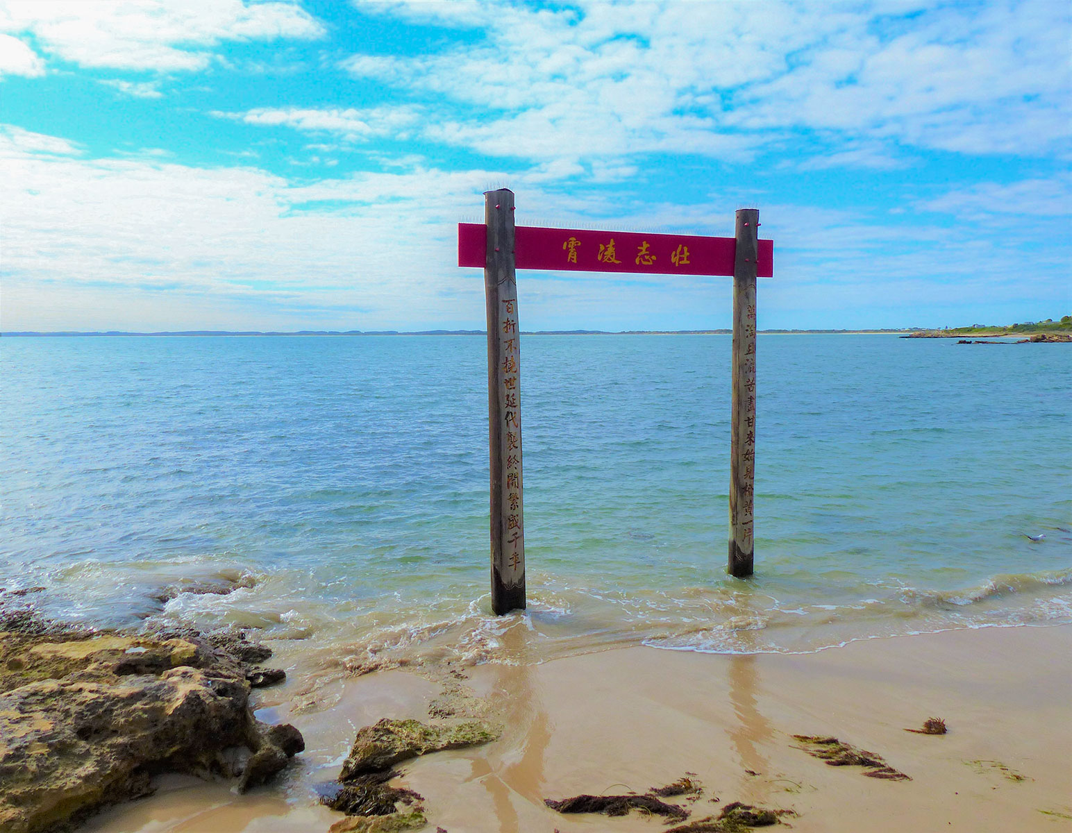 Robe - Pai Fang Gate
The would-be miners landed at Robe rather than Melbourne to avoid Victorian Government taxes and restrictions placed on Chinese migration: Victoria charged £10 per person for entry to the state, which was more than the Chinese paid for their sea voyage to Australia.
South Australia, in contrast, mostly allowed free entry for Chinese, resulting in the 35 ships that arrived at Robe over the six-year period.
Victoria’s goldfields were hundreds of kilometres from Robe, so the new arrivals had no choice but to walk. With local guides, some said to be unscrupulous, they travelled along bush tracks in single file up to 35km a day, shouldering bamboo poles carrying their worldly possessions.
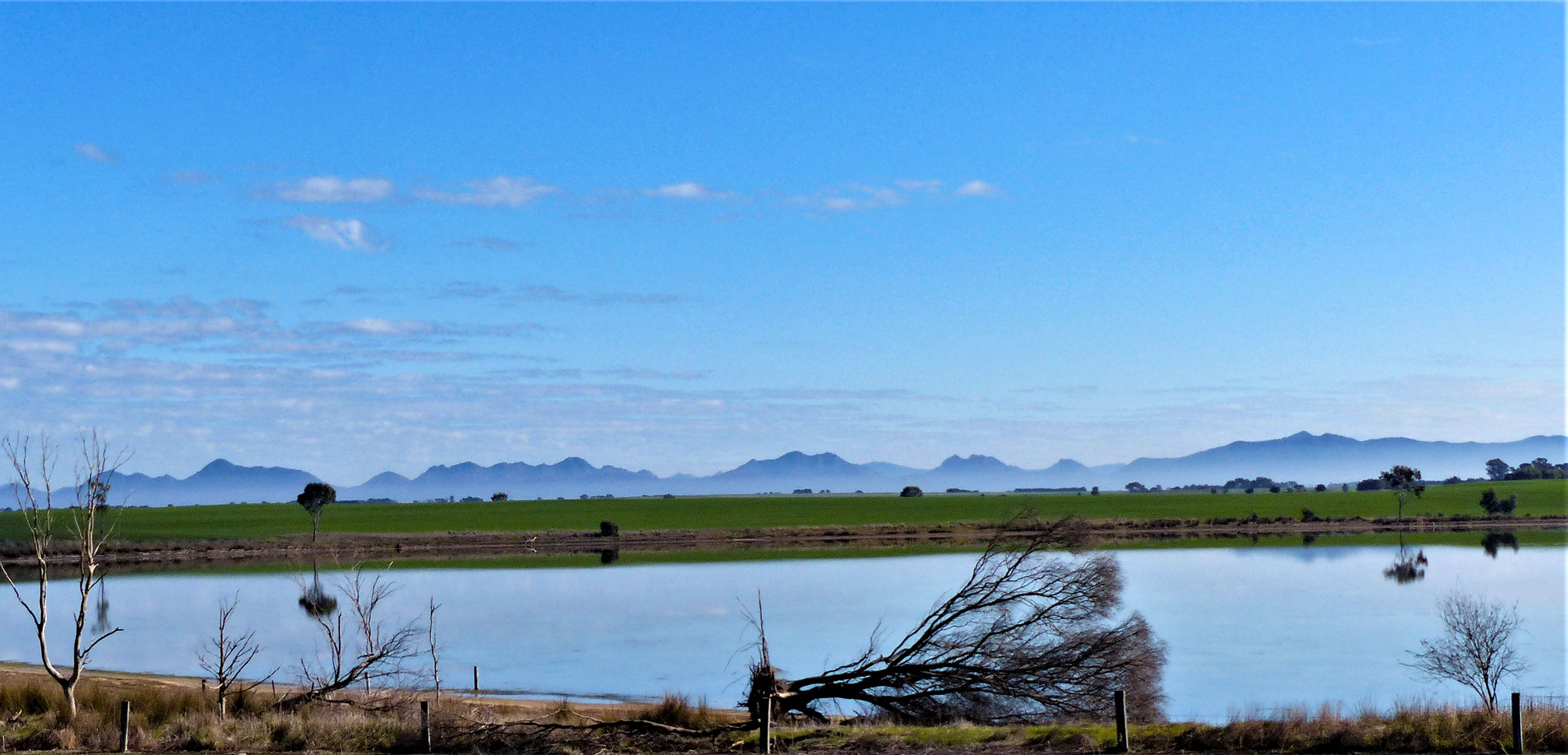
From Robe they skirted around Lake Eliza, 17km south of town and now home to the Little Dip Conservation Park. Little Dip conserves a number of small lakes throughout the park. Each lake has its own character, ranging from the open, marshy and shallow Lake Eliza to the salty Big Dip Lake and deep Fresh Water Lake.
This area was home to the Boandik people for thousands of years, and there are shell middens in the area. Samphire flats surrounding the lakes are popular with birdwatchers, and surrounding beaches ideal for beachcombing and surf fishing.
From here it’s around 30km across flat pasturelands to Kangaroo Inn via Clay Wells. Across farmlands are channels to drain swamps, but early settlers, including Chinese, would have waded through swamps.
Kangaroo Inn is home to the Kangaroo Inn Area School, a large school amid surrounding farmlands, and the ruins of Kangaroo Inn, built in 1860 and a stopping point for scores of Chinese. The Kangaroo Inn was unlicensed, but nevertheless ran a popular liquor trade and was once a rowdy place. Near the school are limestone blocks printed with Chinese characters.
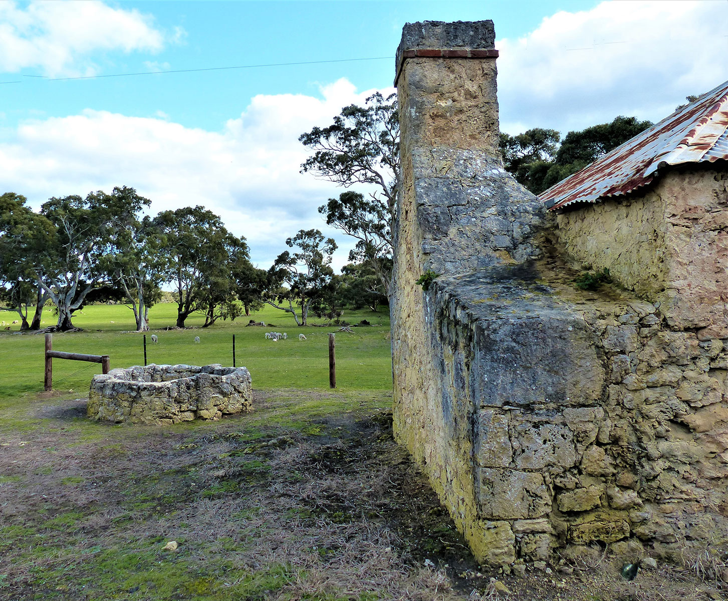 Kangaroo Inn ruins
One can only imagine the bewilderment of immigrants as they came across native wildlife such as kangaroo, wallaby, koala, emu, echidna and great flocks of cockatoos - all of which you still see in abundance driving the backroads of southeast South Australia and Victoria’s far southwest.
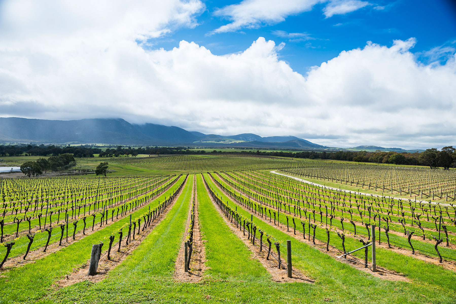
It’s an easy drive past more tranquil farmlands around 50km to Penola, famous as the gateway to the legendary Coonawarra wine region.
The Coonawarra is made up of a sea of 30 vineyards stretching for 14km, which has been producing great wines since the first grapevines were planted in 1891 and is a highlight of any journey.
In town, Petticoat Lane is Penola’s oldest residential area, featuring quaint cottages dating from the 1850s, some of which you can wander through for a glance of life here 170-years ago. While there, pick fresh herbs and vegetables from the gardens for a coin donation.
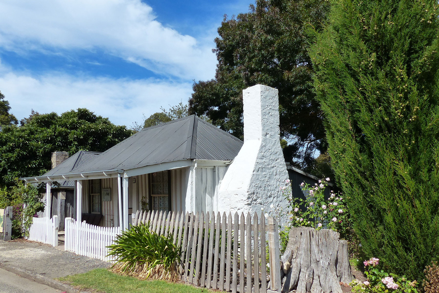 Penola - Petticoat Lane
Many Chinese fortune seekers rested in Penola for a couple of days. Some ended their journey here and established market gardens. Their sojourn is remembered in Chinaman’s Lane, on the outskirts of town.
Penola to Casterton – 62km
Following the C198 to Casterton, the road wends through great swathes of bushland thick with native bush studded with huge grass trees, as well as pine and hardwood plantations.
Once over the border, the Chinese generally avoided towns to escape detection by the Victorian authorities, stopping instead at out-of-the-way inns and station homesteads along the way.
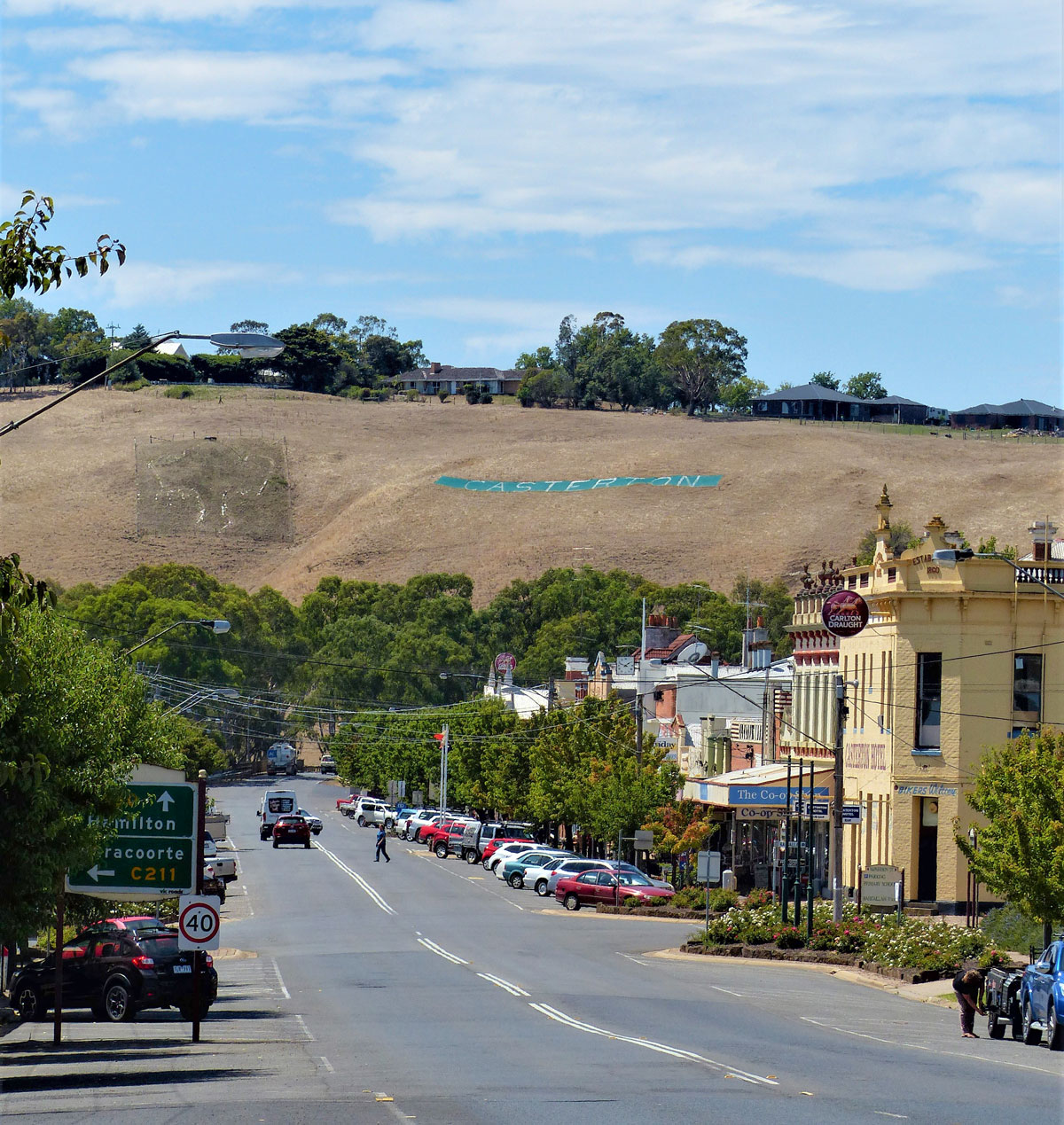 Casterton main street
Chinese walkers generally followed rivers and creeks, and also dug wells along the routes to ensure water for themselves and other countrymen following them to the goldfields.
In lieu of a direct road in the 1850s, tracks in the bush between Penola and Casterton led to huge pastoral properties such as Warrock Station, Chetwynd Station and Wando Station.
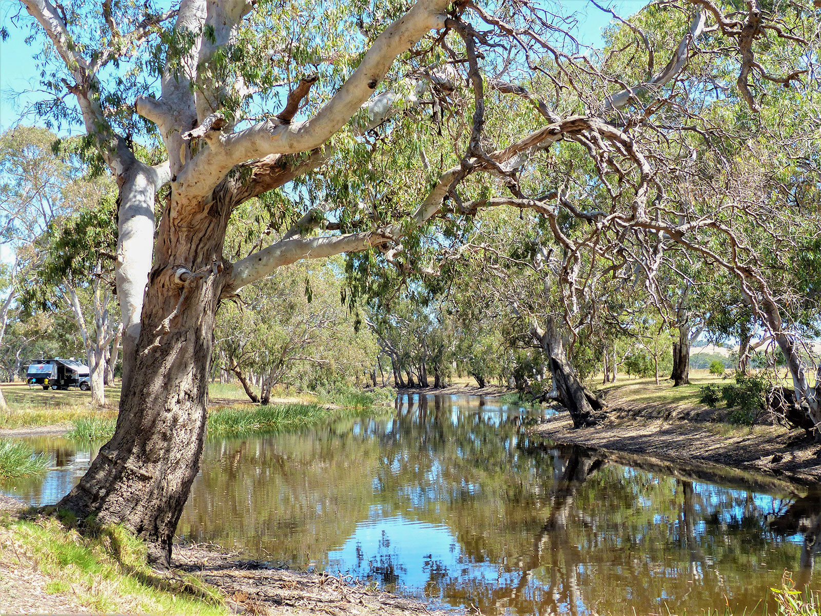
McKinlay’s Glenelg Inn on the Glenelg River in Casterton was another popular place to pause – and still is today.
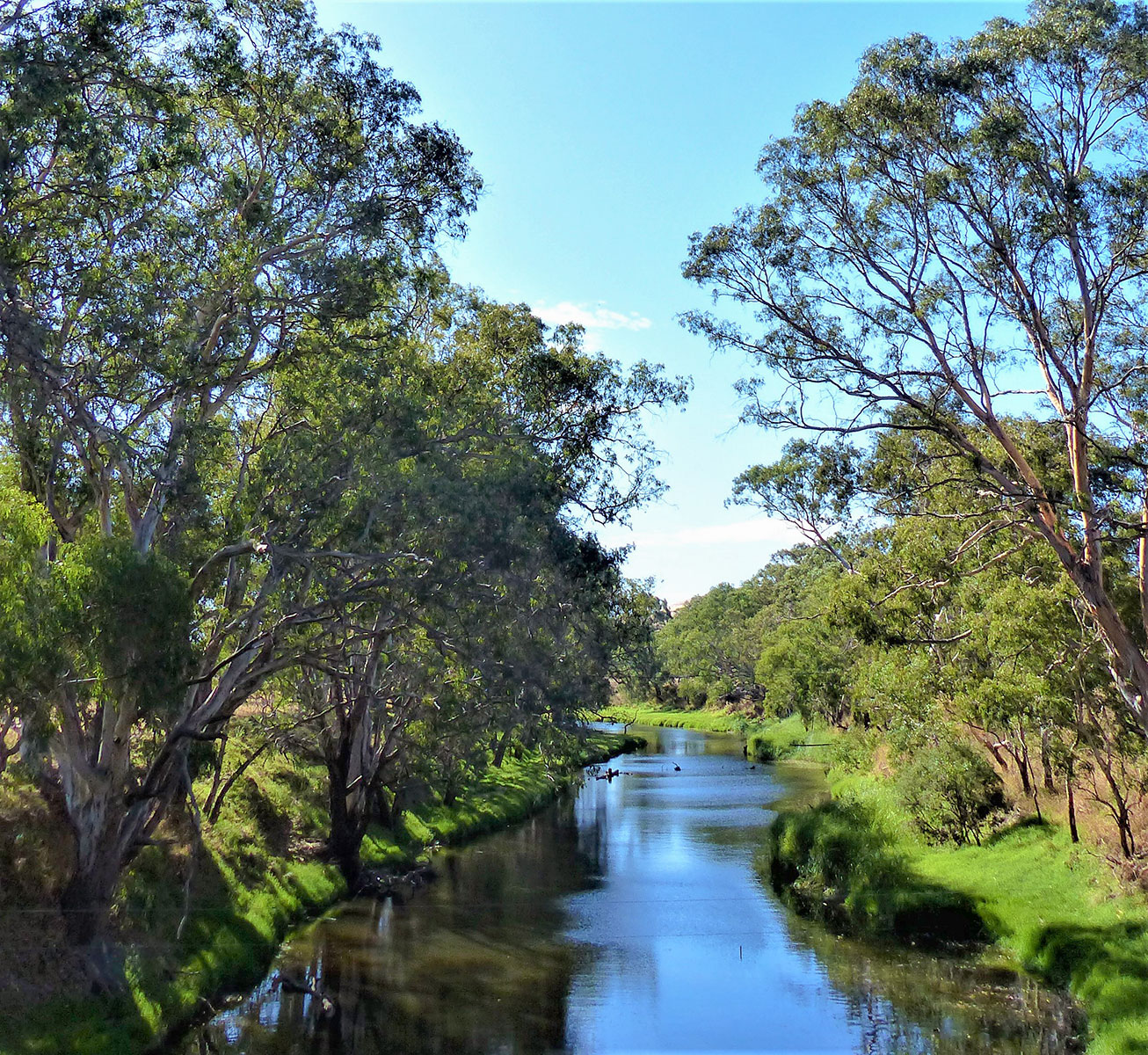 Glenelg River in Casterton
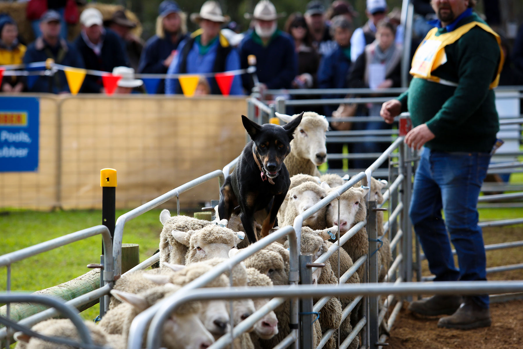
Dating from 1846, Casterton, population around 1800, has retained much that is charming about many country towns, including a parade of historic buildings. Driving through town you invariably see utes with barking kelpies in the back, which are as much a part of the fabric of the town as the majestic redgums lining the riverbanks.
Casterton’s main thoroughfare is also home to the Australian Kelpie Centre, celebrating Casterton’s role in the origins of Australia’s iconic working dogs. Renowned for their loyalty and tenacity as they work with all types of livestock, kelpies were originally bred from Scotch Collies in the 1870s at nearby Warrock Station, which dates from the 1840s.
Each year on the Queen’s Birthday long weekend dog-lovers gather in Casterton’s old streets for the annual Australian Kelpie Muster, which includes the Kelpie Festival and the Australian Premier Working Dog Auction.
Casterton to Cavendish – 67km
From Casterton the B160 snakes through hilly countryside with glorious vistas of hills and dales – usually verdant for nine months of the year – towards the historic town of Coleraine. In the middle of town is the turnoff to Cavendish, another small and historic town.
Between here and Cavendish you pass old house sites with gnarled peppercorn and fruit trees, scattered farmhouses, cattle and sheep-filled pastures, great, gnarled redgums, and tracts of bush.
This undulating countryside is reminiscent of some of the famed landscapes of Great Britain. But there are no tourists here and, on this leg of the journey, no towns. It is completely silent, save for the bleating of sheep and occasional screech of cockatoos.
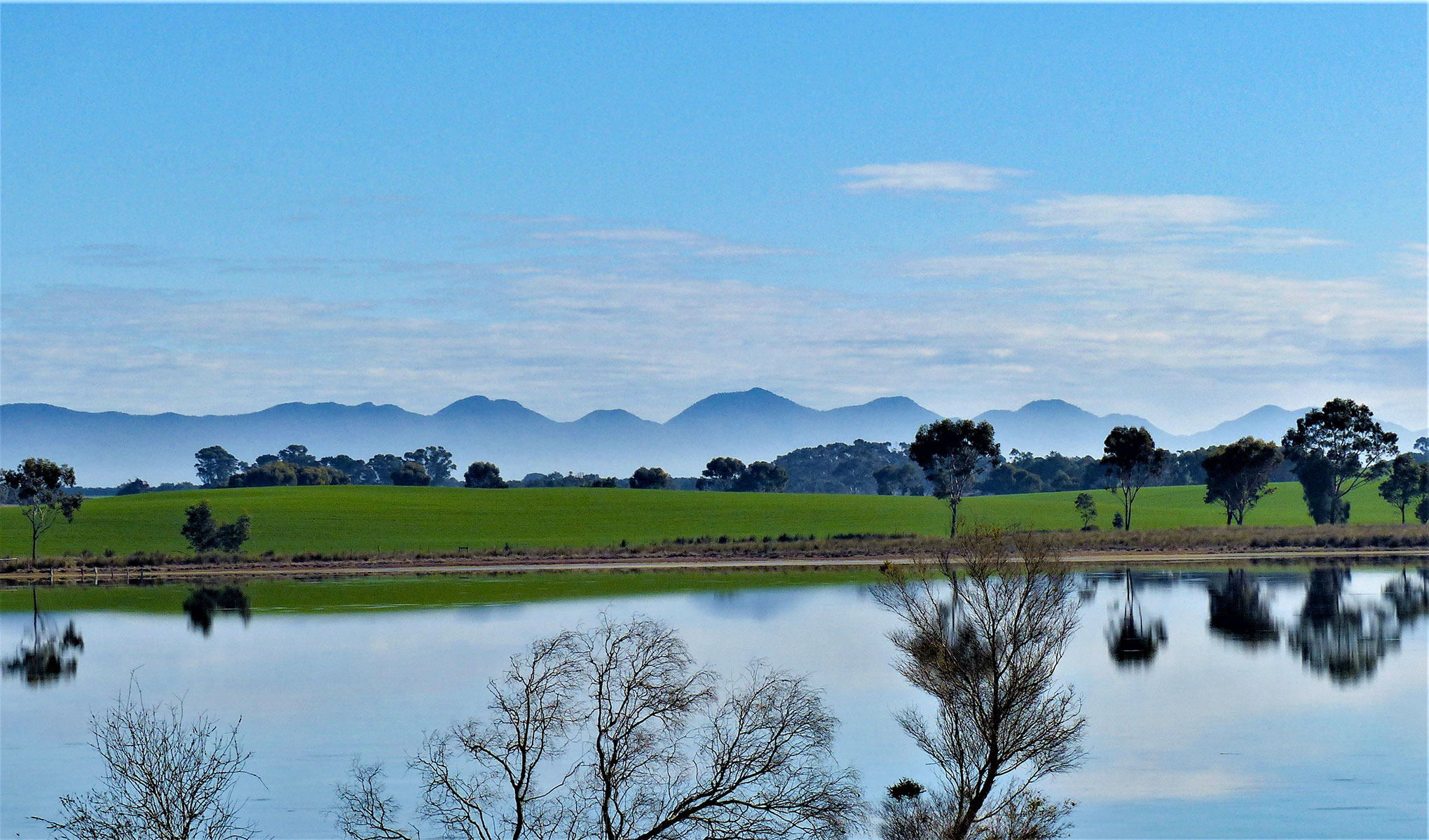
About 30kms from Cavendish the jagged blue grey of Gariwerd - the Grampians Range - emerges in the distance, and the mountainous range, around 100km long and 55km wide, becomes more formidable the closer you get to town.
The Wannon River flows through Cavendish, which has four churches, a memorial hall, a general store that includes the Bridge Café, and the Bunyip Hotel, a Cavendish institution since the 1840s. The Bunyip Hotel was established as Waddell’s Inn in 1842. The Bunyip you see today was built in 1938 when the old hotel was demolished.
The hotel’s award-winning chef, James ‘Jimmy’ Campbell, grew up in the Cavendish area, where his family has farmed for generations, before heading to the bright lights of Melbourne and Sydney to hone his skills at multi-award winning MoVida Restaurant.
Campbell returned to Cavendish in 2017 and, with business partners Matt and Elisha Nettleton, has transformed the Bunyip Hotel into one of regional Victoria’s top foodie destinations.
Cavendish to Dunkeld – 32KM
From Cavendish it’s a 37km drive across more spectacular countryside to Dunkeld, overshadowed by some of the largest of the Grampians southern peaks, including Mount Sturgeon.
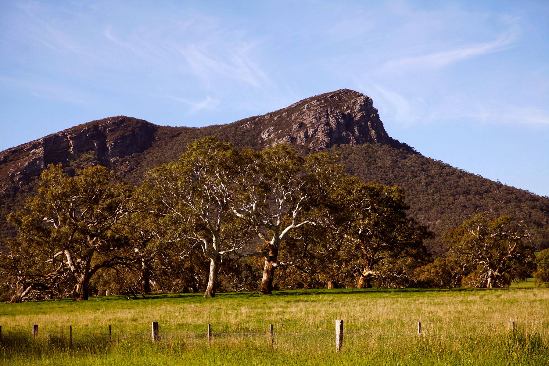
It is little wonder Chinese miners skirted the immense range, its rugged slopes looming majestically across the landscape.
At Mount Sturgeon Station, on the outskirts of Dunkeld, is a stone fence built by the transient miners. The wall is a short walk from the Mount Sturgeon lookout on the highway.
At the foot of Mount Sturgeon, which is the southern tip of the Grampians, is the village of Dunkeld.
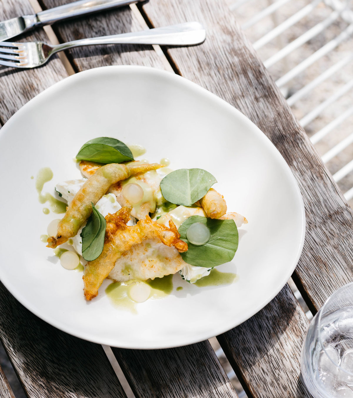
Dunkeld’s charming main street features several trendy cafes, booklovers heaven at Roz Greenwood’s Old and Rare Books, the wonderful Dunkeld Old Bakery, operating in the same location since 1887, and culinary nirvana at the Royal Mail Hotel, regularly voted one of Australia’s best dining destinations.
 Dunkeld - meal at Royal Mail Hotel
Dunkeld to Ararat – 76km
From Dunkeld, 19km along the Glenelg Highway finds you in the small town of Glenthompson and the turnoff to Ararat, 57kms northeast.
For Chinese miners, who completed this journey in around three weeks, the walking was exhausting - muddy in winter and hot and harsh in summer.
Today, from the comfort of our 4WD, we pass vast fields of vibrant yellow canola on the drive - on a sunny day a dazzling contract against electric blue skies - across relatively flat pasturelands, taking in amazing views of the Grampians from the east.
A cluster of silos loom in the distance, and before long is the turnoff to the small town of Willaura, population around 500, and well worth a pitstop to visit the Willaura Bakery, said to be Victoria’s oldest continuous running bakery and renowned throughout the region for its sweet and savoury delights.
In April 1857, a group of more than 700 Chinese miners walking from Robe to the Clunes goldfields in central Victoria found alluvial gold while replenishing their water supplies in a stream. Their Canton Lead was to become the richest shallow alluvial gold field ever discovered.
For the first five weeks, the stream on a hill was known as Canton Lead, then Mount Ararat, later shortened to Ararat. Today Ararat’s Gum San Chinese Heritage Centre traces the history of Ararat’s origins and Chinese immigrants, housing a fascinating selection of interactive displays.
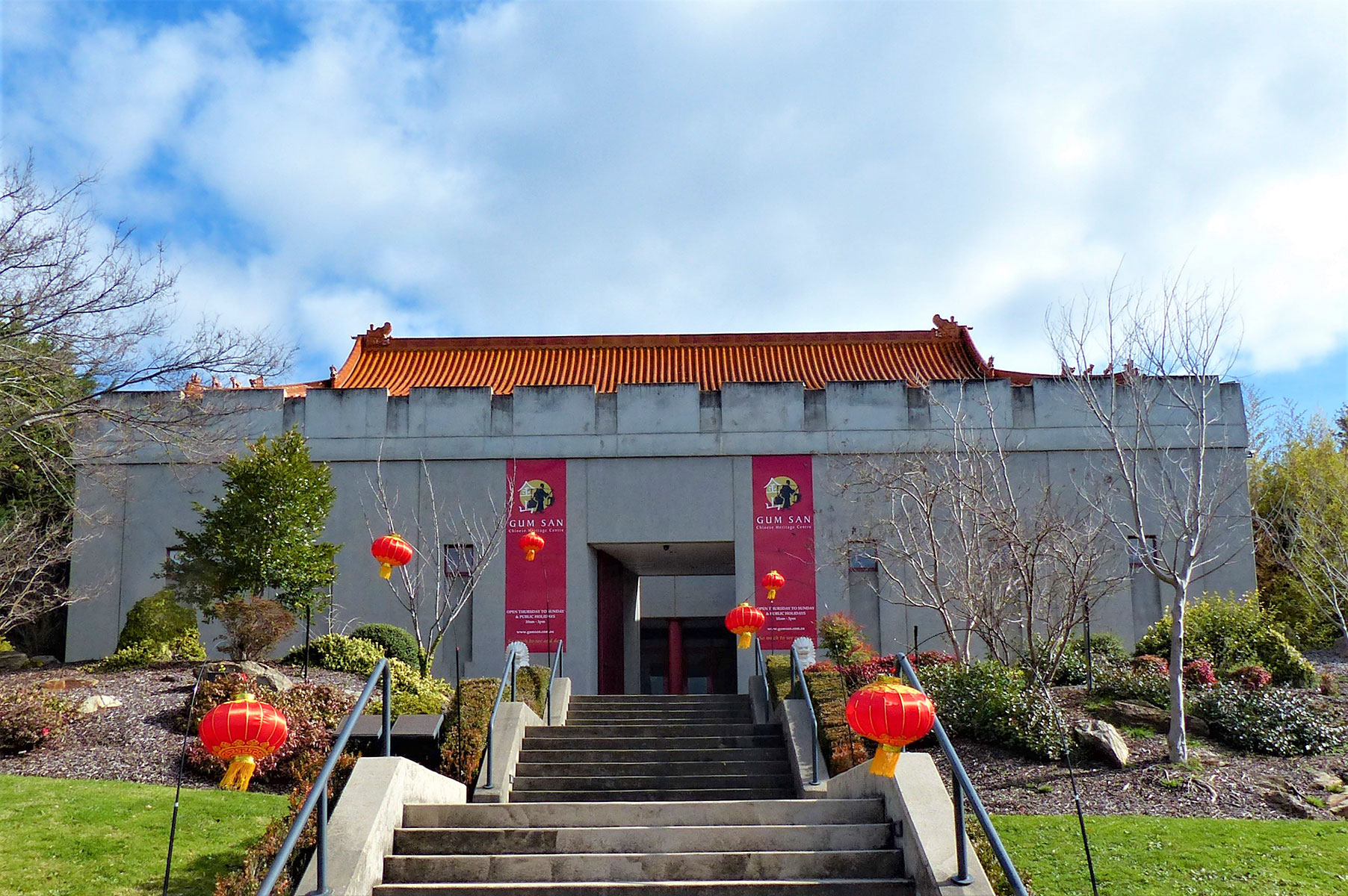 Gum San Chinese Heritage Centre
The stream where the miners first camped runs beneath the museum and flows into pretty Lake Alexander below.
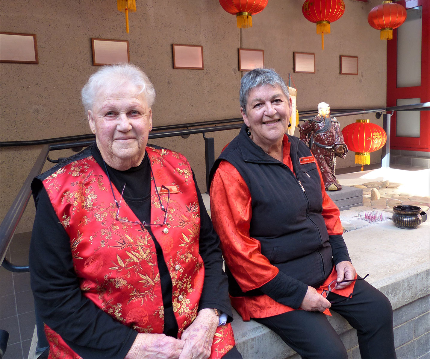
“The miners kept their gold finds to themselves but let the cat out of the bag when they went to nearby Cathcart for provisions, paying with gold,” said Heather Lockland, a volunteer at Gum San Museum for more than 20 years. “Within four weeks, 20,000 people had arrived in the area, including more than 4,000 more Chinese.”
The area positively boomed: 93kg of gold was shipped out in the first three weeks, and three tons were officially escorted from town in the first three months, which is mind-boggling given gold is currently more than $2,500 per ounce.
A hospital, water supply, cemetery, botanical gardens, mechanics institute, church and courthouse began to be built the following year. At its zenith, Ararat’s population was more than 50,000.
By the 1860s the mining boom was over, but Ararat continued as a prosperous town servicing a huge agricultural district dominated by wheat and wool. Today Ararat has plenty of grand historic buildings from its boomtown days and is a bustling regional shopping centre.
One sprawling complex high on a hill on the outskirts of town is Aradale, a labyrinth of 63 mostly Victorian buildings built in 1863. In days gone by anyone who had a psychological illness or condition such as epilepsy or autism could find themselves in an institution such as Aradale, originally called the Ararat Lunatic Asylum.
This huge mini metropolis of dormitories, dining halls, workshops and sprawling grounds was, thankfully, emptied of its last patients in 1993. Guided tours of this eerie place are held each Wednesday and Sunday.
Those deemed criminally insane were housed at J Ward, a network of grim bluestone buildings two kilometres away. A goldfields prison dating from 1859, the goal was made a ward (J Ward) of the Ararat Lunatic Asylum in 1888 and continued in that role until 1991. Tours of this ghostly complex are run daily.
Ararat’s Canton Lead was mined until 1912, leaving five kilometres of tunnels and drives beneath the city.
While many Chinese migrants eventually returned home, some chose to make a permanent home in Victoria, where their descendants live today. Taking in all that history is thirsty work. As luck would have it, Ararat is part of the Grampians wine region, renowned for its high-quality wines and scenic vineyards.
Visitor Info
Getting there: Robe is 335kms south-east of Adelaide on the Southern Ports Highway. Or drive from Melbourne and make it an extension of a trip along Victoria’s Great Ocean Road and cross the border at Mount Gambier.
Stay:
Robe Holiday Park has powered sites from $35 per night for two people. Quiet, shady, five minutes from town centre and five-minutes to Long Beach.
Sea Vu Caravan Park has powered sites from $38 per night. Direct access to sandy beaches, waterfront sites, kiosk, camp kitchen, playground.
Also along the beach, Discovery Parks-Robe has powered ensuite sites from $35, powered sites from $32. Kids’ activity room, playground, indoor heated pool.
Robe’s Lakeside Tourist Park has powered sites from $35 per night. On the sheltered shores of Lake Fellmongery, camp kitchen, playground, shade, grassy sites.
Long Gully campground and The Gums campground at Little Dip Conservation Park are suitable for caravans, and available from $17.50 per night. Basic, drop toilets.
Penola Caravan Park has powered sites from $38 per double. Laundry, barbecues, bike hire, wood fires.
Coonawarra Bush Holiday Park, next to a vineyard and bushland, has powered sites from $15 per person per night, as well as glamps and cabins.
Island Caravan Park Casterton has powered sites from $28 per night. Near Glenelg River, walk to town, over the road from swimming pool.
Cavendish Campground at the recreation reserve has powered sites for $15 single, $20 per couple per night. Camp kitchen, wood fireplaces, toilets and showers, plenty of shade. Caretaker collects fees.
Dunkeld Caravan Park has powered sites from $38 per double per night. Wonderful views of the Grampians. Laundry, park kitchen, walk to cafes.
Ararat’s Acacia Caravan Park has powered sites from $30 per double. Fenced pet sites, shaded grassy areas, pool, enclosed camp kitchen, playground, shop.
G’Day Parks Ararat has powered sites from $30 per night. Ensuite sites (from $40), kiosk, playground, BBQ, pool, camp kitchen.
Free camping:
Casterton’s beautiful Ess Lagoon has free camping for up to one month for recreational vehicles that are fully self-sufficient.
Willaura Recreation Reserve has free camping. Toilet block, shower, shade, drinking water. Some powered sites available.
Green Hill Lake, 4km east of Ararat, has free camping (most donate $5). Amenities block has hot showers, fire pits, playground, lake well-stocked with trout.