Known as ‘The Roof of Queensland’, the central Queensland Sandstone Belt forms a rugged, isolated spur of the Great Dividing Range, covering 82,000sq km of lofty ranges, deep cliff-lined gorges and stunning limestone formations. It embraces the Consuelo Tableland, the state’s highest plateau with elevations above 1200 metres.
The Roof of Queensland
At its heart, the 3000sq km Carnarvon National Park comprises seven sections that protect a diverse range of landforms and ecosystems. The best known, and most visited, is the magnificent Carnarvon Gorge, but the largest and highest is the Mount Moffatt section to its west. Mount Moffatt itself is a basalt-capped peak rising to 1097m above sea level. The high country around it is a mosaic of writhing sandstone ridges, monoliths and outcrops rising dramatically from broad, sandy plains and open, grassy woodlands. Fringed by escarpments standing more than 700m high, the Moffatt plateau provides spectacular views over serried ranks of basalt-crested ranges flanked by deep valleys.
Ancient origins
The defining element of Mount Moffatt geology is the creamy-white sandstone revealed in its many eroded outcrops. It was created from layers of sand deposited by slow-moving rivers on a broad, flat plain about 190 million years ago. Over millions more years, the silica sediments were compressed into deep beds of stone, which tectonic forces thrust upwards during the creation of the Great Dividing Range. Then, about 25 million years ago, the mighty Buckland volcano erupted near present-day Rolleston, spewing lava over 15,000sq km of central Queensland, covering the sandstone with a layer of basalt.
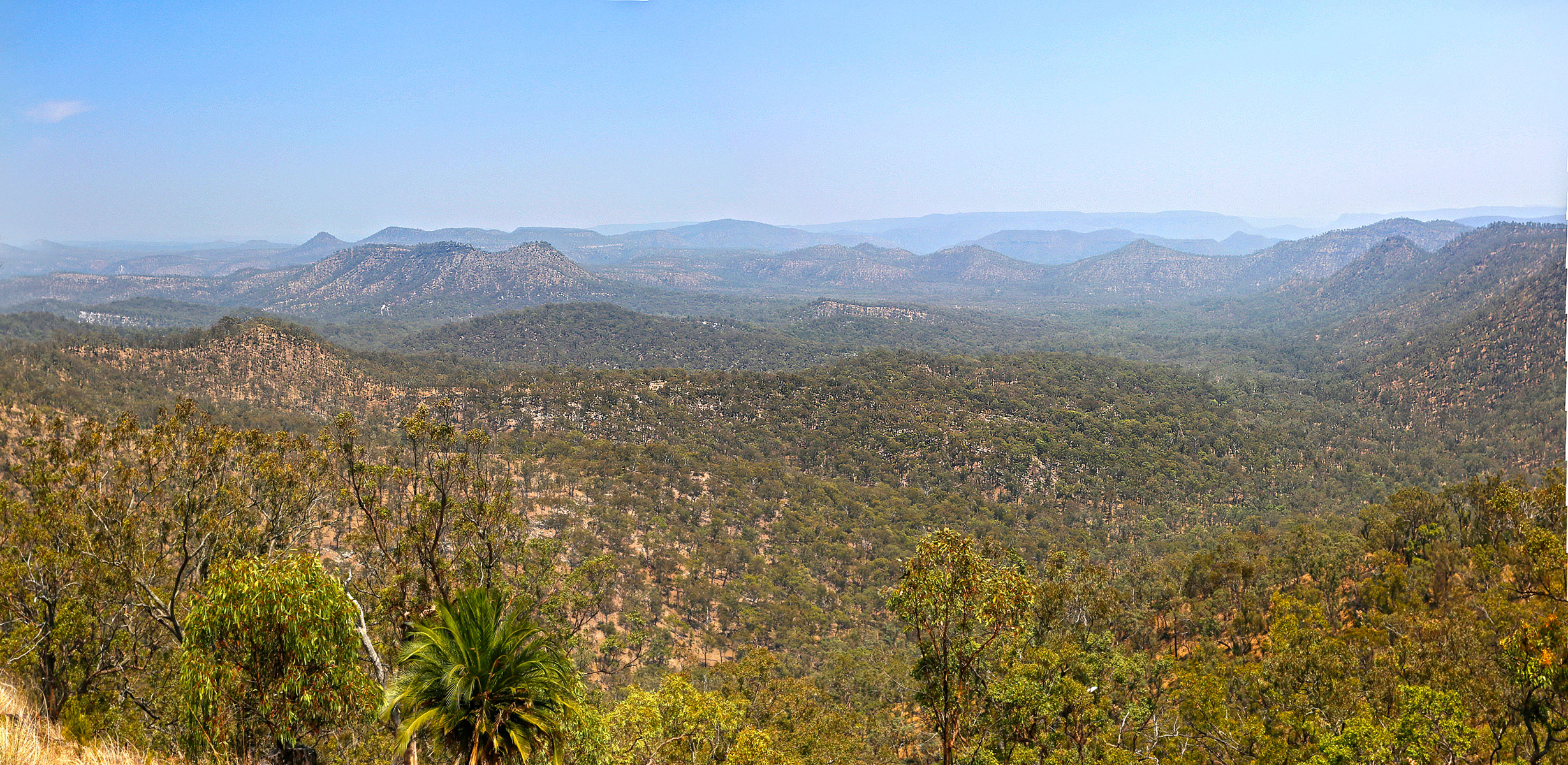


Over ensuing millennia, rain-fed streams etched channels into the volcanic crust as they radiated off the plateau onto the surrounding plains. Carnarvon Creek carved deeply to expose the soft sandstone of the cliffs flanking Carnarvon Gorge. In contrast, the Mount Moffatt landscape was shaped by the Maranoa River, which eroded broad valleys leaving isolated bluffs and pillars of rock projecting from sandy plains. Over time, the elements sculpted these outcrops into the impressive formations we see today, with caves, overhangs, holes and arches.
Home of the Rivers
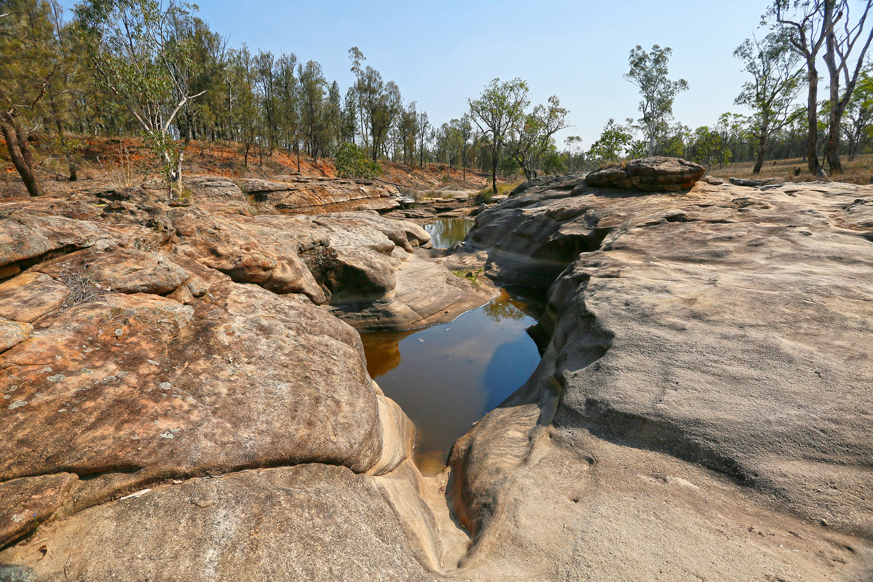
Today, the Consuelo Tableland encompasses the headwaters for five major rivers, earning the region’s other title, ‘The Home of the Rivers’. Fed by numerous perennial springs and more than 1000mm of rainfall each year, creeks draining the plateau to the north and east feed the Nogoa, Comet and Dawson Rivers, which eventually join the Fitzroy River and flow into the Coral Sea near Rockhampton. Mount Moffatt's high country forms the upper catchment of the Maranoa and Warrego Rivers which flow south into the Murray-Darling Basin. The creeks and rivers of Mount Moffatt flow only after heavy rain, but several semi-permanent waterholes dot the landscape, such as Dargonelly Rock Hole near the camping area of the same name.
The natural environment
Carnarvon National Park lies within the Southern Brigalow Belt bioregion which contains flora and fauna unique to Central Queensland.
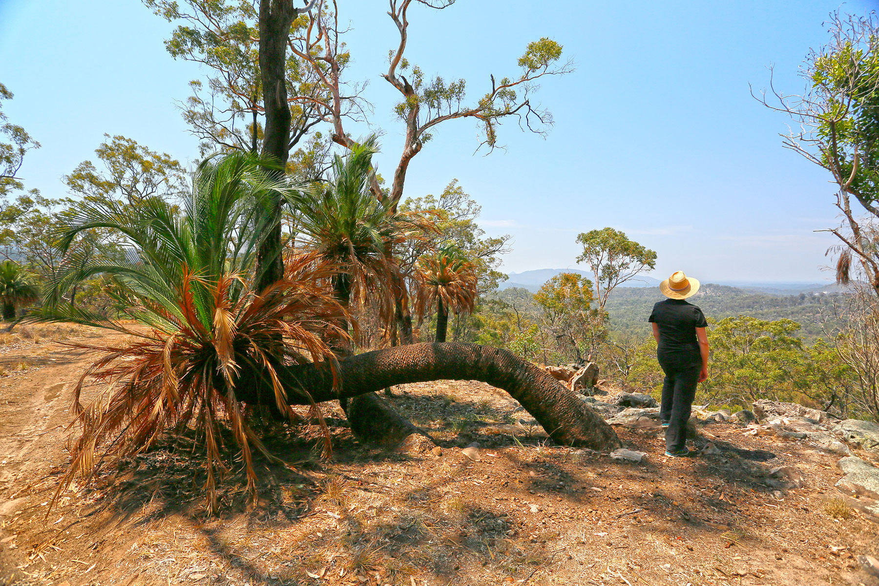
Mount Moffatt’s varied landscape and mix of sedimentary and volcanic soils support a rich mosaic of plant communities - open woodlands of beautiful salmon-pink smooth-barked apples, dense groves of white cypress pine, patches of spinifex and heath, enclaves of brigalow and softwood scrub (dry rainforest), swathes of native grass and bracken fern, and forests of majestic blue gums. In all, more than 750 species vegetate the landscape, of which 23 are rare or threatened.
These varied habitats are home to a huge array of animals. Sixty species of mammals include koalas, red and grey kangaroos, rock wallabies, echidnas and elusive feathertail gliders. Bats comprise about one-third of the park’s mammal fauna, with 20 species recorded so far. Mount Moffatt is popular with birdwatchers for its 210 recorded species, ranging from emus and wedge-tailed eagles to honeyeaters, lorikeets and parrots. Of the 90 species of reptiles found in the park, almost half are skinks and geckoes, and four are endemic to the tableland.
The Indigenous landscape
The Mount Moffatt area is the traditional country of the Bidjara and Nuri Aboriginal people, who inhabited its sandstone ranges for almost 20,000 years before the arrival of European settlers. Through countless generations they developed a powerful spiritual connection with the land, based on the belief that many creation beings resided in certain places or were metamorphosed as particular features of the landscape.
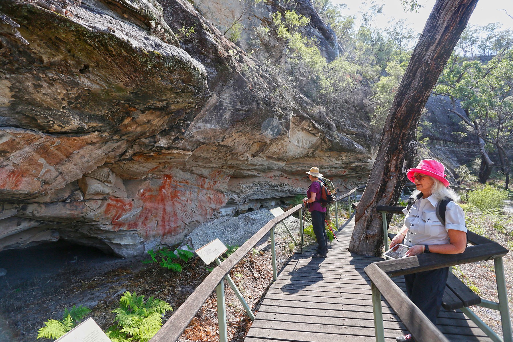
Extensive physical evidence of indigenous occupation exists at many locations around Mount Moffatt in the form of rock art sites, burial places and occupation sites. One place of special archaeological significance is Kenniff Cave, where excavations in the 1960s revealed campfires and an unusually large range of stone artefacts that have been carbon-dated as far back as 19,500 years ago. Unfortunately, the cave is geologically unstable and is closed to the public for safety reasons.
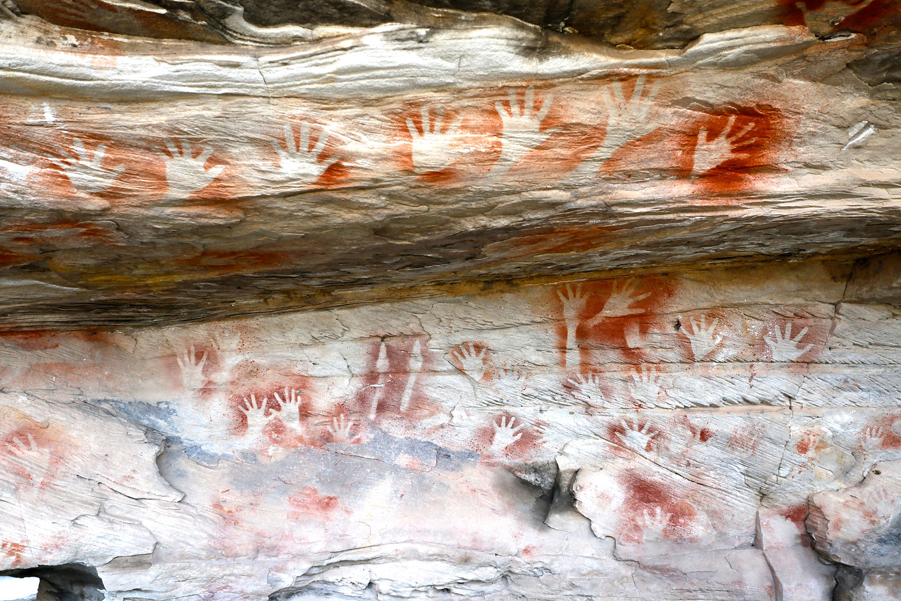
The spectacular assemblage of rock art at Mount Moffatt is considered to be among the most sophisticated and anthropologically significant in the world. Not merely decorative, the images stencilled, painted and engraved in the sandstone outcrops tell the story of the rich social and ritual life of the region’s original people. Often found at important ceremonial sites, the imagery expresses their spiritual connection with the land.
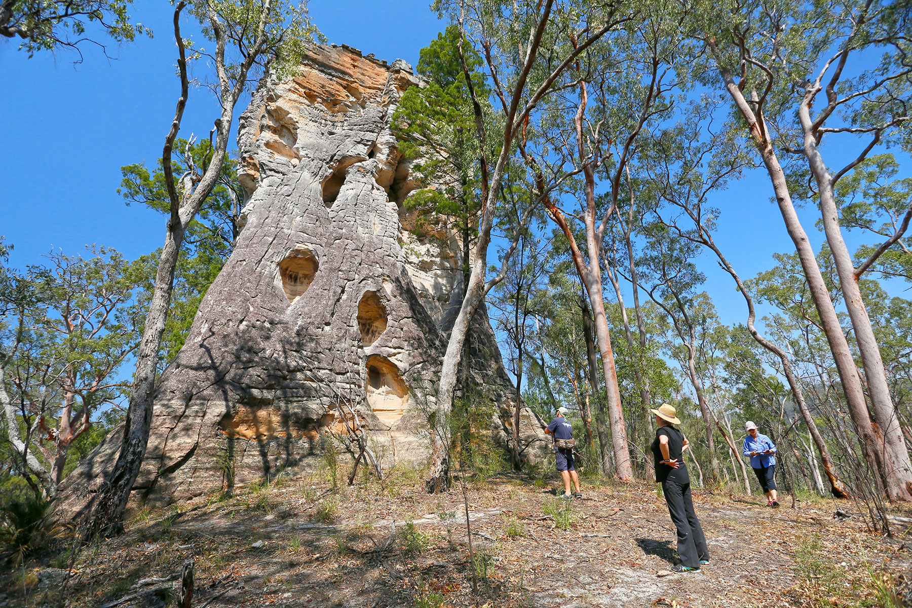
The Tombs, for example, is a place of immense cultural significance where, it is believed, the spirits of ancestral creator beings sleep within the rock. The holes in this huge sandstone cliff face were used as burial chambers and the shallow cave at its base has been decorated with more than 400 stencils, including the only full adult body stencil known to exist in the world. The site can be visited on a walking trail along the west branch of the Maranoa River.
European history
The first European known to visit the Mount Moffatt area was Thomas Mitchell. In 1846, during an expedition to find a northern route for expanding settlement, he travelled along the Chesterton Range, west of Mount Moffatt, and camped on the Nogoa River in what is now the Salvator Rosa section of Carnarvon National Park. Mitchell named the Carnarvon Range, after the fourth Earl of Carnarvon. Mitchell was followed a year later by Edmund Kennedy when his expedition passed through in search of the fabled 'inland sea'.
Both explorers reported in glowing terms about the area’s permanent water and the grazing potential of its grassy uplands. Guided by Mitchell's sketch maps, settlers moved into central Queensland, and by the early 1860s much of the upper Maranoa River was taken up for cattle stations, with the Mount Moffatt run established in 1867.
This incursion by white settlers was staunchly resisted by local Aboriginal tribes, whose warriors waged a determined guerrilla campaign over two decades. The protracted, and at times brutal, conflict claimed many lives on both sides and slowed the advancement of settlement on this frontier. Depleted by casualties and decimated by European diseases such as smallpox and influenza, the Aboriginal groups were overwhelmed and forcibly removed to distant reserves at Taroom, Woorabinda and Cherbourg.
Thereafter, pastoralism flourished unimpeded by conflict in the sandstone country and grazing was conducted around Mount Moffatt until it was acquired as part of the national park in 1979. Many stock yards and other relics of this cattle industry still exist around the park. The homestead built by the Waldron family in 1939 is used as the current ranger's residence, and a nearby hut built in the 1960s as quarters for jackaroos and later as a schoolhouse for station children, now serves as an information shelter.
Moonlighting and murder
A dark chapter in the region’s pastoral history concerns the notorious Kenniff brothers, Patrick and James, now regarded as Australia’s last bushrangers. They arrived in the area in the late 1890s and worked as jackaroos on local stations before taking up ‘cattle-duffing’ (‘moonlighting’) and horse stealing. Corralling the cattle in duffing yards they built in remote canyons and living like nomads in the plateau’s rough country, they managed to elude the police for a couple of years.
In early 1902, Constable George Doyle and Christian Dahlke, the manager of Carnarvon Station, set out to arrest the Kenniffs and eventually confronted them in Lethbridge's Pocket, north of Mount Moffatt. After an exchange of gunfire which killed the pursuers, the Aboriginal tracker, Sam Johnson, escaped to alert police at Mitchell.
Returning to the area several days later, the police found a packhorse carrying saddle bags containing the charred remains of Doyle and Dahlke, and a large flat rock in a nearby creek bed bearing evidence of their recent cremation. One of Queensland's largest manhunts ended three months later when the brothers were arrested near Mitchell. Both were convicted of murder at their trial in 1903 and, proclaiming his innocence to the end, Patrick was hanged. James was sentenced to life imprisonment but was released in 1918. He died at Charters Towers in 1940.
Out and about
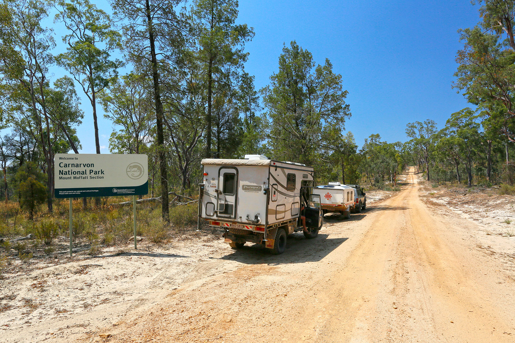
Mount Moffatt is a drive-orientated section of the national park, with most features a short walking distance from stops along a road network that extends throughout the plateau. Exploring the area in its entirety can easily cover more than 100km, with some back-tracking, so make sure you have plenty of fuel for the tour and enough to get back to town. While the unsealed tracks are mostly accessible by 2WD vehicles, high clearance 4WDs are recommended and definitely required for the rough, steep sections between the Rotary Shelter Shed and the Head of Carnarvon Creek. All roads within the park may be impassable for days after heavy rain.
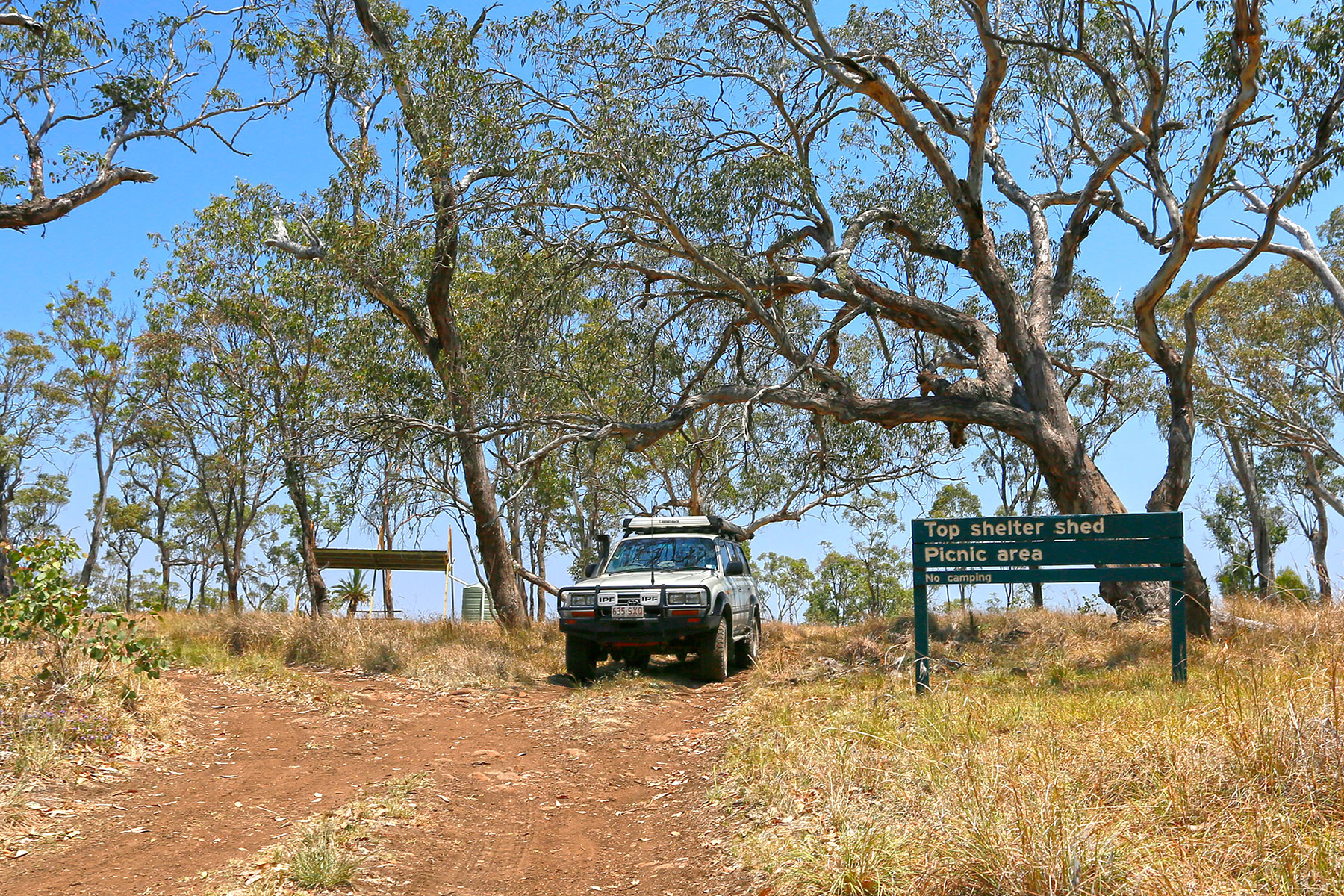
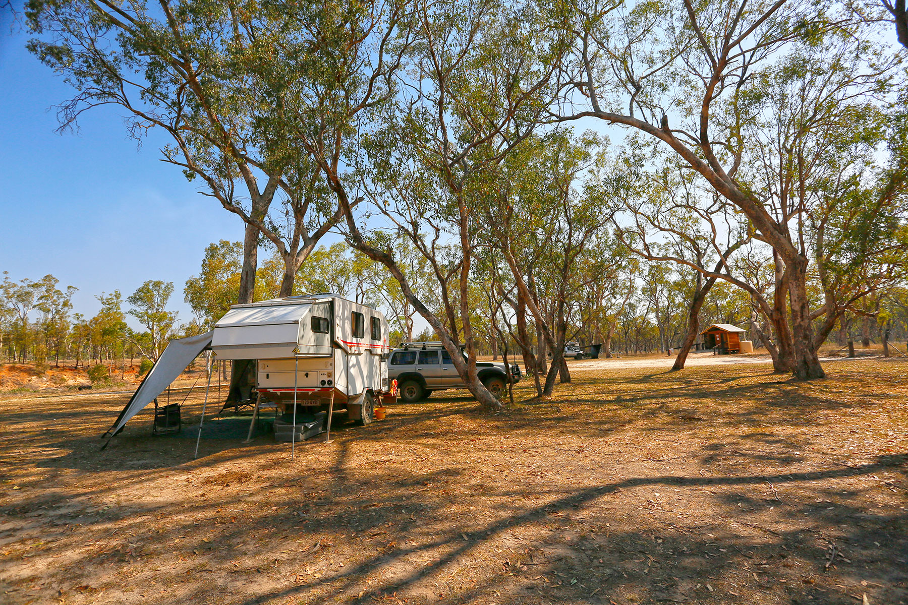
 View at the Rotary Shelter Shed camping area
A brace of amazing natural attractions is connected by a 5km circuit walk from the visitor orientation site near the park entrance. The Looking Glass (aka The Duchess) is an isolated sandstone pillar through which the elements have carved a hole. Three vertical pillars comprising The Chimneys stand side by side at the narrow end of a small bluff. The large outcrop incorporating The Tombs sacred site looms out of the open forest near a bend in the Maranoa’s sandy riverbed.
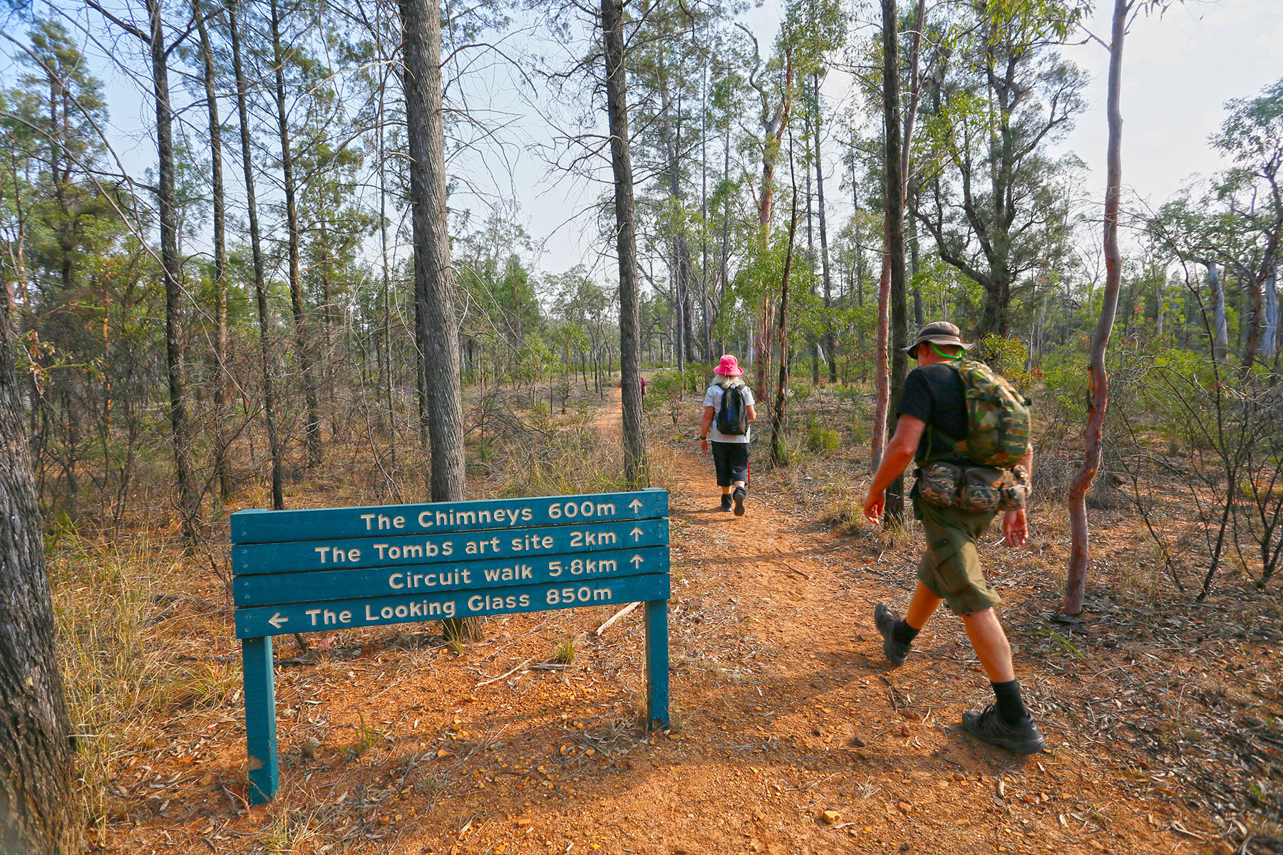 Stepping out along the Circuit walking trail
On the other side of the road from the orientation shelter, a short track leads to Cathedral Rock, a sandstone bluff with unusual rectangular patterns created by water erosion along faults in its grey, weathered surface.
Passing the Dargonelly Rock Hole camping area, the circuit drive leads to trailheads for more natural features on the edge of the Marlong Plain - the impressive Marlong Arch, the Kookaburra Cave rock art site of engravings and stencils, and the isolated pillar of Lots Wife. A short distance from Lots Wife, the circuit loops back along Long Gully and the turn-off to the West Branch camping area.
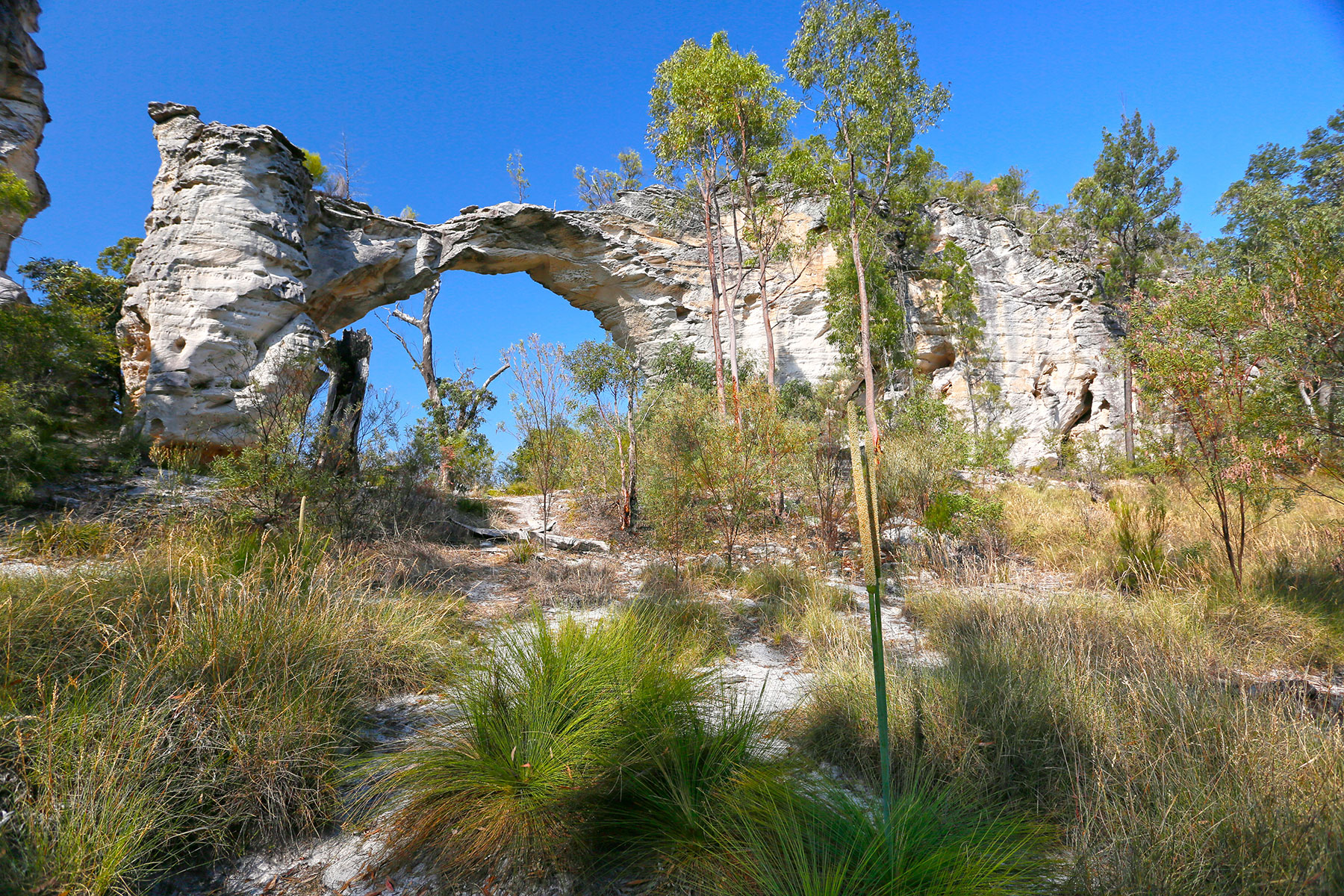 Marlong Arch is an iconic formation within the national park
Continuing straight ahead at the loop junction leads to the Rotary Shelter Shed camping area and the Top Shelter Shed on the edge of the Consuelo Tableland. This is a great place for a picnic with panoramic views over the park and surrounding countryside. From here, you’ll need to engage low range for the climb to the magnificent Mahogany Forest high up on the tableland, and the end of the track overlooking the headwaters of Carnarvon Creek to the east.
Camping
Mount Moffatt has four camping areas in tranquil bushland settings. Dargonelly Rock Hole and West Branch camping areas are open, grassy spaces with sites suitable for off-road caravans, motorhomes and camper trailers. Facilities include toilets, fire rings (bring your own firewood) and limited supplies of water (boil before drinking). The Top Moffatt and Rotary Shelter Shed camping areas are only accessible by high-clearance 4WD vehicles and offroad-capable vans and trailers. The Rotary site has a picnic shelter, toilet, wood barbecues and water. Top Moffatt has a toilet and fire rings but no water. Permits are required for all camping areas and fees apply.
 Dargonelly Rock Hole camping ground
Mount Moffatt VISITOR INFO
Location: The Mount Moffatt section of Carnarvon National Park is 600km northwest of Brisbane via Roma or Mitchell on the Warrego Highway. It is 220km north of Mitchell or 250km northwest of Roma via Injune.
Access: Both routes are sealed to Womblebank Station, then unsealed to the park entrance on roads that may become impassable after rain. All roads inside the park are unsealed and some can only be accessed by high-clearance 4WD vehicles and offroad-capable vans and trailers.
Best time to visit: This is a year-round destination but best visited during the milder months of spring and autumn. Winter temperatures may fall well below zero, while in summer they may reach over 30°C. Most rain falls between December and March.
Attractions: Spectacular sandstone outcrops, scenic views, Aboriginal rock art, four-wheel driving, bushwalking, historic locations, photography
Camping: Mount Moffatt has four camping areas with basic facilities, suitable for camper trailers and offroad caravans. Permits are required and fees apply.
Other accommodation: A range of holiday accommodation is available in and near the towns of Injune, Mitchell and Roma
Fuel and supplies: Stock up at Injune, Mitchell and Roma. No fuel is available in the park, and you should allow extra fuel for driving the 100km of park roads as well as the trip back to town.
Contacts:
- Injune Visitor Information Centre
- Roma Visitor Information Centre
- Great Artesian Spa and Visitor Information
- Queensland National Parks online booking